Trails traveled: Mt. Royal Trail No. 1, Difficulty: Black, (Difficult)
Out-and-back, 5.2 mile round-trip, 2,087ft elevation gain
Time: 2 hours, 45 minutes
Weather: Partly Cloudy
- Summit
- Dry
- Frisco
- Dillon Reservoir (Lake Dillon)
- Mountains
- Wildflowers
- Butterflies
- Panoramic
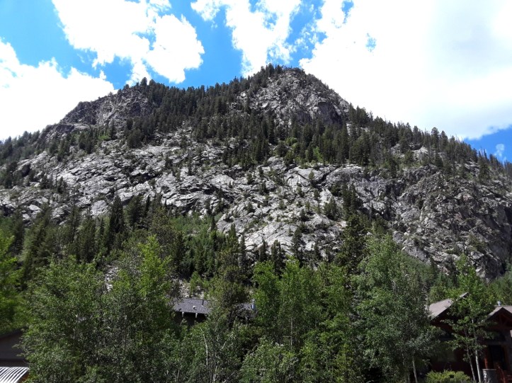
This hike was straight up the mountain. The picture above was the mountain from the ground. Below is a picture of the epic views from the top. This was listed in a summit guide book I have as an “easier” summit in Colorado.
The trip to the top of Mt. Royal is 2 miles both ways, but after I reached the summit of Mt. Royal, I made an attempt to go on and summit Mt. Victoria, which is about another mile and a half from Mt. Royal. After about half a mile I was running low on water and energy.
I did however find a perfect spot to look out over Frisco, Lake Dillon, Silverthorne and the city of Dillon. I also had a nice view of Buffalo Mountain, Red Peak, and Uneva Peak from my vantage point. There was a outcropping of rocks I climbed up off the trail to look out and reflect on things.
The views on top of the mountains were awesome making the soreness I feel now completely worth it. This was definitely a hard hike. The elevation gain is really strenuous as you ascend.

